"Only those who risk going too far can possibly find out how far one can go."
 |
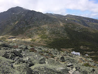
| Start of the Great Gulf Trail |
I was maybe a little sore when I woke up on Thursday morning from my speedy race across Franconia Ridge the day before. However, the weather was looking to be much warmer. Kathy and I made plans to knock off some of her 4k's that she still need for her completion. She had 4 in the Presidentials. Madison, Adams, Washington, and Munroe. She wanted to try and get as many as she could, so our plan wasn't set in stone.
We had made plans to meet at Pinkham Notch Visitor Center at 7:30am. We would leave a car there and drive to our starting point. She had asked about Pine Link Trail. When she arrived at PNVC I had asked if she didn't mind doing Osgood Trail, because I didn't like Pine Link for all of it's PUD's (pointless ups and downs). She agreed to it so she jumped in my car and we headed to the Great Gulf Trailhead.
We were running a little behind schedule and started around 8:30am. Started up Great Gulf trail for about 1.5 miles until the junction of Osgood. Osgood is part of the Appalachian Trail, so I had imagined it would be a pretty gradual ascent. We were making great timing headed up. Eventually popping out of tree line and having our first views of the presidentials. Clouds were rolling in and out covering some summits but then quickly blowing off.
As soon as we started up the little bumps of the top of the Osgood Trail I immediately could feel the sun at my back warming up my neck quickly. I stopped to throw some sunblock on. We continued onward and upward. Stepping through and around lots and lots of spider webs. Most of you who have hiked in the Presi's know those really LARGE ugly fury black spiders that are all over the rocks... Yeah, well I HATE them and they were everywhere. If you think the flowers are out in full bloom, well so are the spiders.
ALPINE FLORA:
As we came to the last bump just before the actual summit of Madison, I stepped to the side and let Kathy pass me. As this was a summit I had been to several times before and this would be her first time. I am not sure why, but I always enjoy when other hikers I am hiking with let me tag the summit of a new one I have never been on if they have already been there. It just makes the feeling of accomplishment for me, that much more satisfying.
 |
| Mount Madison Headstand |
WE DID IT! Kathy got her photo on the summit and I had forgotten to take my headstand photo on this peak when I last hiked it with Trish, the girls, and John. So, I asked if she wouldn't mind getting a photo of me doing a headstand. Once done with taking photos, we continued down to the hut to stop for bathrooms, water, and some grub. In passing we ran into Kitty and her partner and their little stuffed animal, that I had just recognized on the 4000 Footer group that morning from a previous post! It was great to meet all of you, and I enjoy following photos of things like that! Happy trails.

At the Hut we went inside and used the rest rooms. Not realizing it until after we came out, Kathy looks at me and laughs, "We just used the mends room." haha woops. eh, it's all the same when you're in the woods. We sat outside for a few minutes giving the legs a break and re-assessing our situation and how we felt. Knowing we had a bail out option of turning around. Kathy was determined to get Adams since it was right there.
 |
| Madison Spring Hut/ Mount Madison |
We packed up our stuff after agreeing to keep moving forward. We started up the Gulfside Trail and headed South towards Mount Adams. Adams always looks way more difficult than it feels. At least in my opinion. After the climb of 1 mile to the summit we finally made it. Again, I stepped aside letting her pass me and tag the summit first. Her smile was so big! It's moment's like that, that I really do remember why I enjoy hiking with others. Once up there though, the bugs were horrendous! Black flies everywhere, in your mouth, in your hair, on your skin, and up your nose. Oh the joys of being a hiker sometimes.


I had asked Kathy if she wanted to try for Mount Washington, and she very much did. We both decided we would go around Jefferson and Clay in hopes of making up some lost time. However, the further we went the more tired and late it got. We had one last bail out option before hitting MW. Once we reached the col of Clay, and the junction of the Sphinx trail, I looked at the map, checked the time and let Kathy know we would be hiking out in the dark regardless, and that heading towards MW is going to be difficult. It was so close, but we both decided together it would be best to just get down quickly and safely while we still had daylight.
 |
| Looking back. |
 |
| Mount Adams Summit! |
 |
| Jefferson Snow Patch. |
We decided to head down the Sphinx Trail. This would be 1.1 miles until it joined back with the Great Gulf Trail. This would be the first time for myself and her on this trail and I had a feeling it would be a little wet, but nothing like what we experienced. As we started down, almost immediately there were some scrambles, then a very large snow patch that obviously no one had been down before us. Within another few minutes the trail then became a stream of water, and then literally a waterfall. I kid you not when I say we literally were standing and hiking through a waterfall. It was a little intense in some sections.

We both just took our time, not rushing anything and being incredibly cautious. Eventually making it off this trail and onto the Great Gulf Trail it was like relief for a moment. Then there was a stream crossing literally at the top of a fall. We managed it, and at this rate I didn't care about getting wet, I just wanted to be safe because that water was roaring down stream. I looked at my map, and the trail claims to run on the east side of the trail for a few miles before another crossing, later to realized this trail has obviously been rerouted due to falling trees, landslides, and wash outs. We had to cross the river several times, looking for small cairns to find the way. This went on for a good 3 miles before FINALLY getting to a suspension bridge crossing we were hoping to get to before it got dark.

We crossed, had .8 miles until we reached the Osgood junction of where we started and then another 1.5 miles out to the car. Darkness came and I broke out my amazing headlamp. We moved much faster as it was getting pretty late and we were hoping our families and friends weren't worrying too much about us, even tried to send quick texts to let them know we were ok. About a mile from the car Kathy's phone rang and it was her boyfriend Peter. He had decided to come hike in to meet us on the GG trail. It was a pleasure to see a familiar face and know how close we were.
 |
| Part of the Waterfall crossing we did. |
We all chatted as we walked out, making it back to the car very late. I quickly said my good byes and headed home. I couldn't wait for a hot shower, food, and my bed. A long journey through the woods, but such a fun one. Sometimes things just don't go as planned, but as long as you have your wits about you and can be OK with the fact that the mountains will always be there, you will always be the one to walk away from what could have been a bad situation.
 |
| Land Slide/Washout on GGT |
 |
| Wash out/ Landslide |
 |
| Falls on the Sphinx Trail |
This hike was a great learning experience and a great reminder that no matter how bad you want something, sometimes the timing just isn't right. Also, as a hiker you must always have a smart head on your shoulders in order to make the right decisions and calls. I think the two of us together did all of the right things, and that is what made our journey and exciting one to now talk about forever.
One mistake I did make on this journey, that I always make above tree line... Re-apply. I forgot to re-apply my sun block and now I am paying for it by the wonderful lobster red sun burn all over my arms and legs. But, if that's the worst of my problems, I am one happy hiker!
Hike Safe & Keep on Trekking!


Comments
Post a Comment